Mission Photograph Albums - Maps-Charts #01 Page_0143
|
|
Dublin CoreTitleMission Photograph Albums - Maps-Charts #01 Page_0143
Date1910s-1920s
CreatorBoard of Missions of the Methodist Episcopal Church
SubjectMissions
Maps
RightsFor permission to use or for higher quality reproduction contact research@gcah.org
PublisherThe General Commission on Archives and History of the United Methodist Church
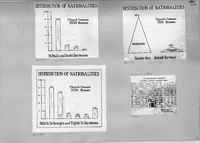
ScriptusTranscriptionH11564 Chart of Distribution of Nationalities in the St. Paul and Scott Territories.
H11565 Chart of the Distribution of Nationalities in the Snyder Avenue and Jewish Territory H11566 Chart of the Distribution of Nationalities in the Fifth Street, St. George's and Eighth St. Territories. H11571 Map of a Chicago Student Community. The Parish of St. Paul Methodist Church StatusStarted
Percent Completed100
Percent Needs Review0
|